Google Earth
Introduction:
Google Earth is an excellent tool for geography. While some may think it is merely to see one's house from space, the GIS abilities to add overlays and study data spatially is a key component to geography.
Google Earth is virtual globe, map and geographical information program. The original name was Earth Viewer 3D, which was created by Keyhole Inc. , which then acquired by Google in 2004.Initial release on June 28,2005 as Google Earth. Maps in Google Earth are available from satellite imagery, aerial photography and GIS 3D.
There were three licenses of Google Earth software named as Google Earth, a free version; Google Earth Plus which is now discontinued had some additional features and Google Earth Pro, which is intended for commercial use cost $399 per year. Google Earth is also available as a browser Plugin, made available for mobile viewers.
For large parts of the surface of the Earth only 2D images are available, from almost vertical photography. Google Earth displays satellite images of varying resolution of the Earth’s Surface. This allows users to see cities, houses. Streets etc. perpendicularly down or at an oblique angle. All Images viewed by Google Earth aren’t of high resolution but some of images of popular cities such as Melbourne, Victoria, Las Vegas, Nevada, Cambridge etc. or popular mountains/valleys like Mount Everest, Grand Canyon etc. also available in three dimensions.
For these 2D and 3D images Google Earth use previously digital Elevation model (DEM) and nowadays use Supplementary digital Elevation model by NASA’s Shuttle Radar Topography Mission. Google Earth supports managing three-dimensional Geospatial data through Keyhole Markup Language (KML).
There are various versions of Google Earth Software. Now there is version 5.0 available in 37 languages including Hindi.
Features:
1. Wikipedia and Panoramio Integration: In 2006, Google Earth added a new layer named “Geographic Web” which includes integration with Wikipedia and Panoramio.
2. Flight Simulator: This feature was included as hidden feature in old version but now it is not hidden. Flight simulator can be used with only few airports and controlled by mouse, keyboard or joysticks. We can experience a very realistic views, also feel like the cockpit of a plane.
3. Sky Mode: This allows users to view stars and other celestial bodies.
4. Water and Ocean: This allows users to zoom below the surface of ocean and view the 3D bathymetry beneath waves.
5. Historical Imagery: This allows users to traverse back in time and study earlier stages of any place. This feature is very useful for research purposes that require analysis of past records of various places.
6. Mars and Moon: For research and information purpose Google Earth provides their high resolution images.
7. Overhead Satellite and Aerial Imagery
8. Ability to create and save Placemarks and folders. Placemarks can either be clamped to the ground, or can appear above ground at a specified altitude
9. Integration with Internet resources
10. 3D Landforms and 3D Buildings
11. Tools for measuring and creating paths
12. Access to a community of users who have developed Google Earth applications
13. Searching:
Users may search (Fly to) using the following parameters:
• Address (street and zip code for US)
• Place Name (eg. Paris, France)
• Latitude/Longitude Coordinates
Flight simulator
Specifications:
Google Earth shows the earth as it looks from an elevated platform such as airplane or orbiting satellite. The projection used for this purpose is named as General Perspective. The coordinate system is geographic coordinate means latitude/longitude.
Baseline and typical high resolutions are different for different countries.Age of images are different, if there are in changes in places due some activities are updated as early as possible.
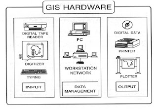
Minimum hardware requirement is P-3, 256 RAM,400 MB free disk, 128kb/s Network speed, 16 MB 3D Graphic Card and Window XP,7,2000,Vista or Linux or Mac OS X.
Now about the licenses provided by Google Earth described as below;
1. Google Earth Plus: This was discontinued in Dec. 2008. This was an individual oriented paid subscription. This included GPS Integration, High resolution printing, Customer support via e-mail, high data download speeds.
2. Google Earth Pro: This is paid version of $399 annual subscription fee. It is Business-oriented. This provides movie making, GIS data importer, Advanced printing modules, Radius and are measurements. This doesn’t work on Linux.
3. Google Earth Plug-in: Google Earth Plug-in and its JavaScript allows users to place version of Google Earth into Web pages but doesn’t provide all feature of Google Earth.
Google Earth Compatible to Google Chrome, Internet Explorer 6.0+, Firefox 2.0+, Safari 3.1+.
Layers:
Google also features with many layers as a source for information on businesses, point of interest and also showcasing the content many communities such as Wikipedia, Panoramio and YouTube.
This includes
1. Panoramio : Most relevant pictures uploaded on Panoramio’s website displayed on Google Earth.
2. Roads: Displays available road networks in different colours according to road types.
3. 3D Buildings: Sows many buildings in major cities in photorealistic and gray view.
4. Borders and labels
5. Weather: This includes clouds, Radar, Conditions and Forecasts.
6. Sky Layers: This consists of Current sky events, Earth and sky podcasts, hubblecast, Our Solar System, Hubble Showcase, Rumsey Star Maps.
Students can use Google Earth to:
• study natural and political maps
• learn map reading and navigation
• visually explore historical, news, and census data
• annotate locations and share with others
• create their own 3D models to overlay on maps


